Environmental information systems
DNV combines environmental data, modelling, Geographic Information Systems (GIS) and our unique expertise to deliver innovative analyses and solutions and help you understand and communicate complex issues
Spatial variations and differences in time can make data difficult to interpret and understand.
Geography is one of the key components in evaluating environmental issues, and GIS can be used for data processing, analyzing, and visualizing data in many dimensions.
We have access to global maritime AIS (Automatic Identification System) data which enable global and regional environmental and risk analysis studies. These have been used for example as input to models for managing shipping risk and environmental performance.
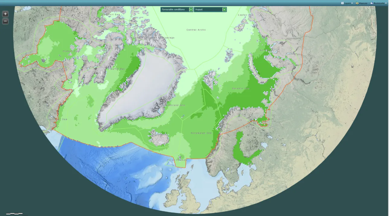
Examples of projects are the circumpolar oil spill response viability analysis performed for EPPR, and the automatic environmental risk assessment of maritime activity performed for the Norwegian Coastal Administration. The purpose of the latter project is to dynamically quantify the environmental risk from maritime traffic in offshore and coastal waters. This is achieved by applying oil spill frequencies and volumes quantified based on maritime AIS data, combined with information on impacts to sensitive habitats and species.
We use GIS throughout the project, from data processing to presenting our findings. Our deliverables include printed maps, web-based reports with interactive maps, and user-friendly customised solutions for the energy sector, maritime, and other industries. Using Esri GIS software, we create solutions that run on desktop, server and mobile platforms.
DNV has also invested in flexible, easy-to-use analysis of historical high-resolution ice and metocean data. These have been used to tackle specific challenges in Arctic offshore operations and can be applied to many other areas.
Our environmental information systems services include:
- Analysis and visualization of environmental data, including metocean data, sensitive species and habitats, and high resolution ice concentrations.
- Innovative environmental analysis, including interactive maps and web GIS solutions.
- AIS-based analysis and statistics.